GeoHaven
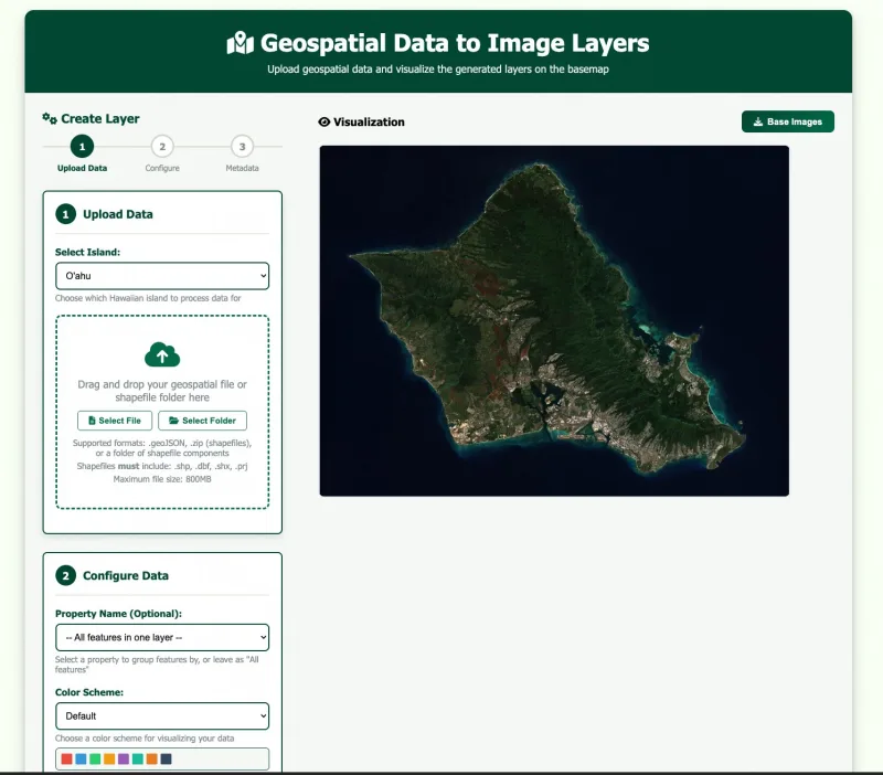
I built GeoHaven to replace a layer-conversion step the team used to do by hand. It takes GeoJSON and zipped shapefiles from the Hawaiʻi State Energy Office and turns them into projection-ready raster layers. Python handles the conversion, with a Next.js interface for researchers to manage their layers.